

Satellite images show collapse of Indonesian island volcano
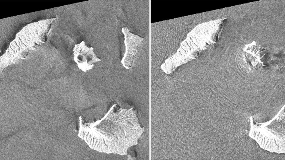
Radar data from satellites, converted into images, shows Indonesia's Anak Krakatau island volcano is dramatically smaller following a weekend eruption that triggered a deadly tsunami. Satellite photos aren't available because of cloud cover but radar images from a Japan Aerospace Exploration Agency satellite taken before and after the eruption show the volcano's southwestern flank has disappeared. JAXA's post-eruption image shows concentric waves radiating from the island, which experts say is caused by ongoing eruptions. Anak Krakatau, which means child of Krakatau, is the offspring of the infamous Krakatau volcano that affected global climate with a massive eruption in 1883. Anak Krakatau first rose above sea level in 1929, according to Indonesia's volcanology agency, and has been increasing its land mass since then.
Source: ABC News December 27, 2018 04:30 UTC