_(1).jpg?disable=upscale&width=1200&height=630&fit=crop)
)

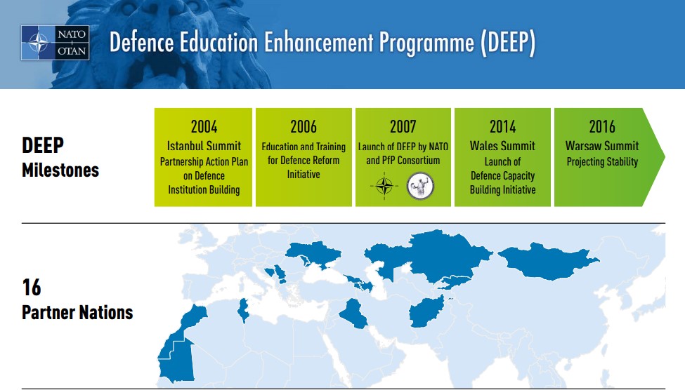
Nato inflames tensions over occupied Western Sahara
NATO has inflamed simmering tensions in north Africa after its website showed a map with Morocco’s border extending deep into the occupied territory of Western Sahara, it was reported today. It represents a change from previous maps which show Morocco within the UN-recognised borders, with Western Sahara separated from it by a line. But the new map’s publication came shortly after the US recognised Morocco’s claims to Western Sahara in exchange for Rabat establishing diplomatic ties with Israel. Western Sahara was annexed by Morocco and Mauritania in 1975 after the defeat of Spanish colonisers. Mauritania withdrew its forces in 1979, but Morocco refused to give up its claim on the land, insisting that Western Sahara was an integral part of the country.
Source: The North Africa Journal January 03, 2021 16:18 UTC